- The WebGIS of the Saigon River project -
A visualization tool
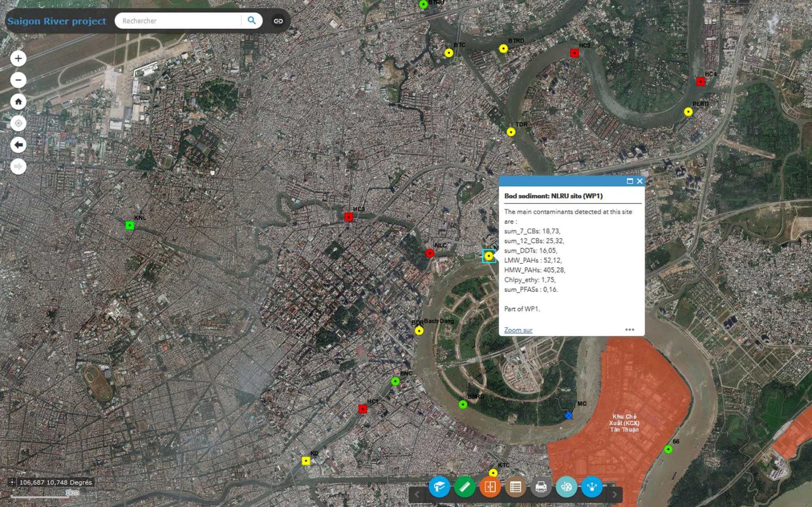
The Saigon River project (2015-2017), had a very strong spatial dimension, and required the development of a dedicated digital mapping tool. It’s the WebGIS, an interactive application allowing to consult cartographic contents. The application takes the entire window but a link (at the top, on the left) allows you to return to the classic Virtual-Saigon interface.
Un outil de visualisation
Le projet Saigon River (2015-2017), par sa très forte dimension spatiale, nécessitait la mise au point d'un outil de cartographie numérique dédié. Il s'agit d'un WebSIG, c'est à dire une application interactive permettant de consulter des contenus cartographiques. Il est accessible ici ; l'application prend la totalité de la fenêtre mais le lien Saigon River Project (en haut à gauche) permet de revenir sur l'interface classique de Virtual Saigon, dans l'onglet dédié au projet.
Last update on Sunday 10 June 2018 (12:02) by E. Senna